The South African Weather Services said that a strong cold front makes landfall on Friday evening along the west coast of the country. Picture: Marilyn Bernard
Durban — There is a chance of showers, strong winds and rough seas in KwaZulu-Natal this weekend.
South African Weather Services (Saws) forecaster Wiseman Dlamini said that for Saturday there was a possibility of isolated showers along the southern parts of KZN.
“It’s a 30% chance at the moment, and then on Sunday, there is a 30% chance of showers and rain over most parts of KZN, except in the extreme north-western parts,” Dlamini said.
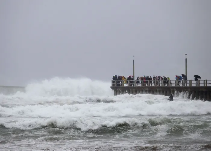
“Something to note again is the possibility of strong winds on Saturday over the Drakensberg region, and then on Sunday there is also a possibility of strong winds along the coast of KZN, and also very rough seas with wave heights expected to reach in excess of 5m.”
Dlamini said that regarding snow, at this stage there was no indication for KZN, but areas like parts of the Eastern Cape and the Western Cape might get some snow.
“For KZN, there is still limited information regarding the snow over our Drakensberg region. However, it is going to be very cold with some temperatures reaching maximums of about 10℃ on Sunday. But in terms of the snow for now, there is no indication,” Dlamini said.
In a statement, Saws said that a strong cold front and cut-off low were expected to affect the Cape provinces this weekend.
Saws said that on Saturday, July 29, a cut-off low would rapidly develop over the Western Cape, further exacerbating weather conditions.
“Although the Cape provinces will experience the brunt of these conditions, the central and eastern parts of the country will also experience cold to very cold conditions from Saturday evening into Sunday,” Saws said.
“Very rough seas (associated with strong winds), with wave heights between 4.0 and 6.0m, can be expected along the west coast from Friday night, spreading along the south coast of the Western Cape on Saturday, to the coast of the Eastern Cape on Saturday night and reaching the KwaZulu-Natal coast on Sunday.”
Saws said that these conditions may cause disruption to beachfront activities and difficulty in navigation at sea for small to medium vessels. High seas with wave heights between 6m and 7m can also be expected along the south coast of the Western Cape from Saturday afternoon into Sunday, spreading to the Eastern Cape coast on Sunday, which could lead to possible beach erosion and put small to medium vessels at risk of taking on water or capsizing.
“Snowfall is expected across the interior mountain ranges of the Western Cape, the western and southern high ground of the Northern Cape and the high ground of the Eastern Cape from Saturday into Sunday, and may extend into the Drakensberg region of KwaZulu-Natal and the extreme southern parts of the Free State on Sunday,” Saws said.
It added: “The weather systems are expected to weaken significantly on Sunday while exiting over the south-eastern parts of the country, causing weather conditions to improve mainly from Sunday evening into Monday. However, heavy ocean swell will continue to impact the southern and south-eastern coastline on Monday due to another cold front slipping along the southern coastal areas.”
WhatsApp your views on this story to 071 485 7995.
Daily News