
Limpopo Transport and Community Safety MEC Violet Mathye is flanked by Dr Jonathan James and Dr Mari Romijn of The Impact Catalyst at the launch of the Limpopo Road Safety Programme.
Image: Supplied
Limpopo, a pivotal region within Southern Africa's road network, plays a crucial role in connecting communities and enabling cross-border trade. The province's main highways, including the N1, R71, and R37, facilitate the movement of thousands of vehicles daily, impacting the lives and livelihoods of many. Despite their economic significance, these routes also present significant risks, making the issue of road safety a pressing concern for the Limpopo Department of Transport and Community Safety (LDTCS).
For years, documenting road incidents in Limpopo posed a challenge due to the manual recording system that failed to spatially map crashes. This lack of accessible data hindered effective planning and prioritisation of road safety measures. However, under the Limpopo Road Safety Programme (LRSP) — an initiative funded by the Anglo American Foundation in collaboration with The Impact Catalyst — a transformative approach is underway to reshape road safety through the use of advanced technology.
The initiative, known as Project 3, has forged a crucial partnership with LDTCS and the Office of the Premier, leading to the development of a Geographic Information System (GIS)-enabled incident dashboard. This innovative tool consolidates provincial crash data into a single map-based view, allowing officials to visualise accident hotspots effectively.
“Having a shared picture of where our highest-risk corridors and communities are makes all the difference,” said Stephen Matjena, Head of Department at LDTCS. “It allows us to direct limited enforcement and investment where they can have the greatest impact.”
The dashboard's proof-of-concept platform, built using ESRI technology in partnership with the Council for Scientific and Industrial Research (CSIR) and other technical collaborators, has undergone rigorous testing and refinement. It now provides insights into pedestrian risk, ambulance response patterns, and historical data categorised by route, district, severity, and timeframes. Officials anticipate the dashboard will influence corridor planning discussions and inform deliberate interventions in high-risk areas.
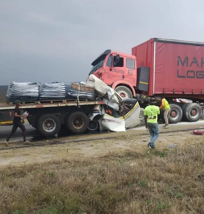
The Limpopo Road Safety Programme is intended to help officials prevent accidents like this deadly minibus taxi crash.
Image: Supplied
Reflecting on the collaborative effort, Dr. Mari Romijn, Head of Department of Capable State at The Impact Catalyst, emphasised the project’s inclusive approach: “The goal was never to build a shiny system in isolation. It was to co-create something practical with provincial teams that can grow into a full road-safety intelligence platform over time.”
The results of this project are already becoming evident. The incident dashboard has established a shared evidence base for LDTCS, the Office of the Premier, the Department of Health, and the Roads Agency Limpopo. This collaborative framework enhances strategic planning, enforcement priorities, and updates to the Limpopo Road Safety Strategy and Action Plan. Furthermore, the integration of the Limpopo Department of Health’s new Computer-Aided Dispatch (CAD) system heralds new opportunities for aligning emergency medical services (EMS) data, offering deeper insights into incident severity, response patterns, and ultimately, patient outcomes.
This dashboard signifies a paradigm shift from reactive responses to a proactive, intelligence-led strategy for improving road safety. In a resource-constrained environment, such practical, data-driven tools can save lives while fostering long-term internal capacity and innovation.
IOS